Peer Reviewed Journal Articles
Predictive Landslide Susceptibility Modeling (2024)
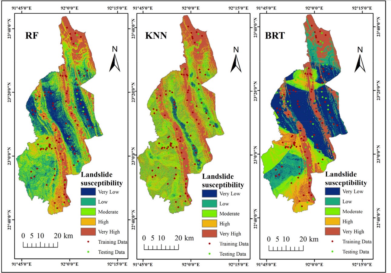
This study presents a novel machine learning–based approach to map landslide susceptibility in Khagrachari district, Bangladesh. By integrating 15 landslide conditioning factors and evaluating three algorithms (RF, BRT, and KNN), the research found that the boosted regression trees model achieved an AUC of 0.95 and an overall accuracy of 82%. The study emphasizes the critical roles of maximum rainfall and elevation, offering valuable insights for disaster management and urban planning.
DOI: 10.1007/s11356-024-34949-5
Greening & Browning Trend Analysis (2024)
This article investigates the dynamic trends in vegetation cover within the Chattogram division using remote sensing data. By analyzing changes in the Normalized Difference Vegetation Index (NDVI) and associated physio-climatic drivers, the study reveals distinct greening patterns interspersed with localized browning. The findings highlight the complex interplay between climate change, land use, and vegetation dynamics.
DOI: 10.1007/s10668-024-05505-5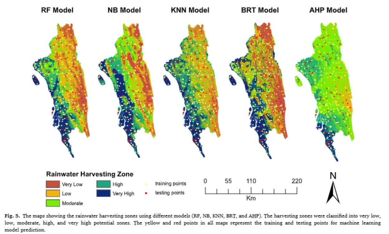
Rainwater Harvesting Potential Zone (2025)
This research evaluates the potential zones for rainwater harvesting in hilly regions of Bangladesh by combining machine learning techniques with the Analytical Hierarchy Process (AHP). Detailed analyses of hydrological and topographical parameters identify optimal areas for sustainable water resource management, providing strategic recommendations for water conservation practices.
DOI: 10.1016/j.jaesx.2024.100189
Cooling Benefits of Urban Lakes (2025)
Focusing on urban climate mitigation, this study quantifies the cooling effects of urban lakes in Dhaka. Using multi-year remote sensing data and statistical analysis, the research demonstrates how urban water bodies contribute to local temperature reduction, thereby mitigating urban heat island effects and supporting sustainable urban design.
DOI: 10.1016/j.hydres.2025.01.001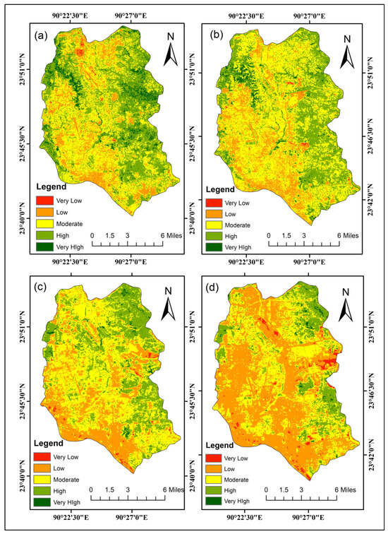
Ecological Environmental Quality Assessment (2025)
Analyzing Ecological Environmental Quality Trends in Dhaka Through Remote Sensing Based Ecological Index (RSEI)
DOI: 10.3390/land14061258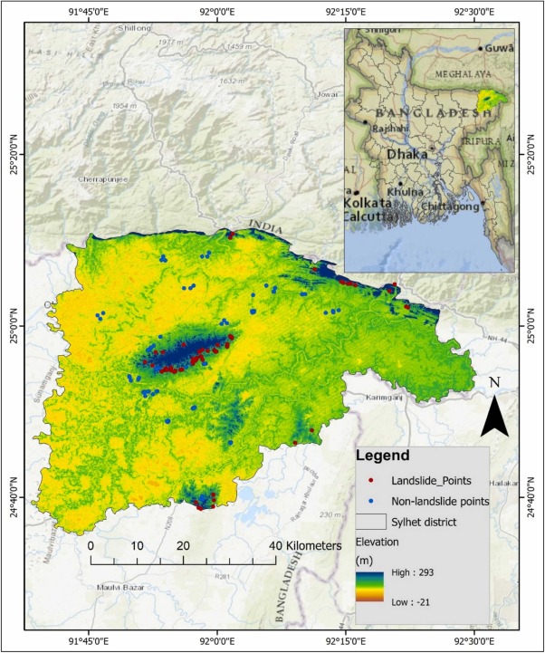
Explainable AI for Lnadslide suceptibility (2026)
Explainable AI uncovers key landslide drivers in northeastern Bangladesh
DOI: 10.1016/j.icee.2026.100007Book Chapters
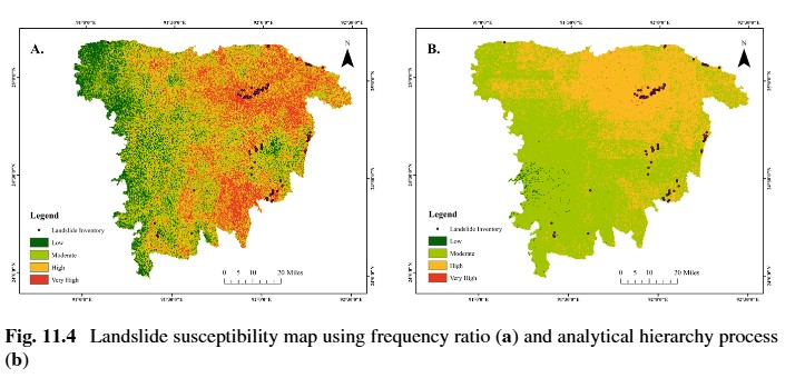
Landslide Susceptibility Mapping (2024)
Featured in a comprehensive volume on Himalayan landslides, this book chapter details an integrated approach for mapping landslide susceptibility using both bivariate and multivariate statistical techniques in combination with GIS. The methodology, which combines the Analytical Hierarchy Process (AHP) with frequency ratio models, effectively delineates high-risk zones and aids in disaster mitigation planning.
DOI: 10.1007/978-981-97-4680-4_11Research Presentations
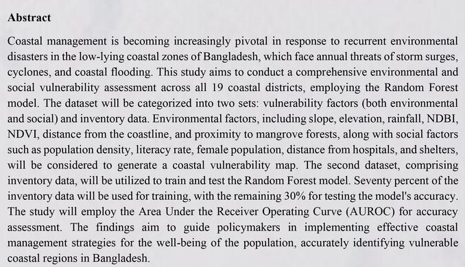
Coastal Vulnerability Assessment (2024)
Presented at an international conference in New Delhi, this presentation showcased a data-driven approach to assess coastal vulnerability in Bangladesh. Emphasizing the integration of remote sensing data and machine learning, the work underscored the critical need for robust hazard assessment in coastal regions to guide disaster preparedness and resilience planning.
Ongoing Research Projects

Novel Remote Sensing-Based Mangrove Ecological Index
Developing a new ecological index using multi-sensor remote sensing data to assess mangrove health, resilience, and carbon sequestration potential. This project integrates hyperspectral imagery, thermal data, and radar backscatter to quantify stressors like hypersalinity, pollution, and sea-level rise impacts unique to mangrove ecosystems.

Forest Canopy Height Prediction Using LiDAR Data
This project focuses on predicting forest canopy height using LiDAR data combined with machine learning algorithms. The research aims to develop accurate models for biomass estimation and carbon stock assessment, which are crucial for climate change mitigation strategies and sustainable forest management.

Predictive Modeling for Ecotourism Suitability on Saint Martin’s Island
In this project, a hybrid machine learning framework is being developed to predict areas suitable for ecotourism on Saint Martin’s Island. The model integrates various climatic and geospatial parameters and is currently submitted to a journal for review.

Analysis of Land Surface Albedo and its Influence on LST
This thesis project examines how variations in land surface albedo affect land surface temperature. The work is in progress and will contribute to a better understanding of urban heat island phenomena.

Assessment of Livability Degradation in Dhaka Metropolitan City
Focused on urban sustainability, this project uses remote sensing techniques to assess livability degradation in Dhaka. By mapping key environmental and infrastructural parameters, the study aims to inform policy for urban improvement.
Peer Review Activity
Journal Reviewer: Scientific Reports
Contributed as a peer reviewer for Scientific Reports, a high-impact journal under the Nature Portfolio. Reviewed a manuscript on groundwater quality assessment, multivariate statistical analysis, and human health risk assessment in Northwest Bangladesh. This role involved critically evaluating the scientific methodology, data quality, statistical analyses, and environmental significance of the research to help maintain the journal's rigorous publication standards.
Journal Reviewer: Geomatics, Natural Hazards and Risk
Served as a peer reviewer for Geomatics, Natural Hazards and Risk, an international journal published by Taylor & Francis. Reviewed a manuscript focused on landslide hazard prediction and received a Certificate of Reviewing in recognition of this contribution. The review involved evaluating the study's methodology, analytical framework, technical accuracy, and scientific significance while providing constructive feedback to support the publication of high-quality research in natural hazards and geospatial science.